
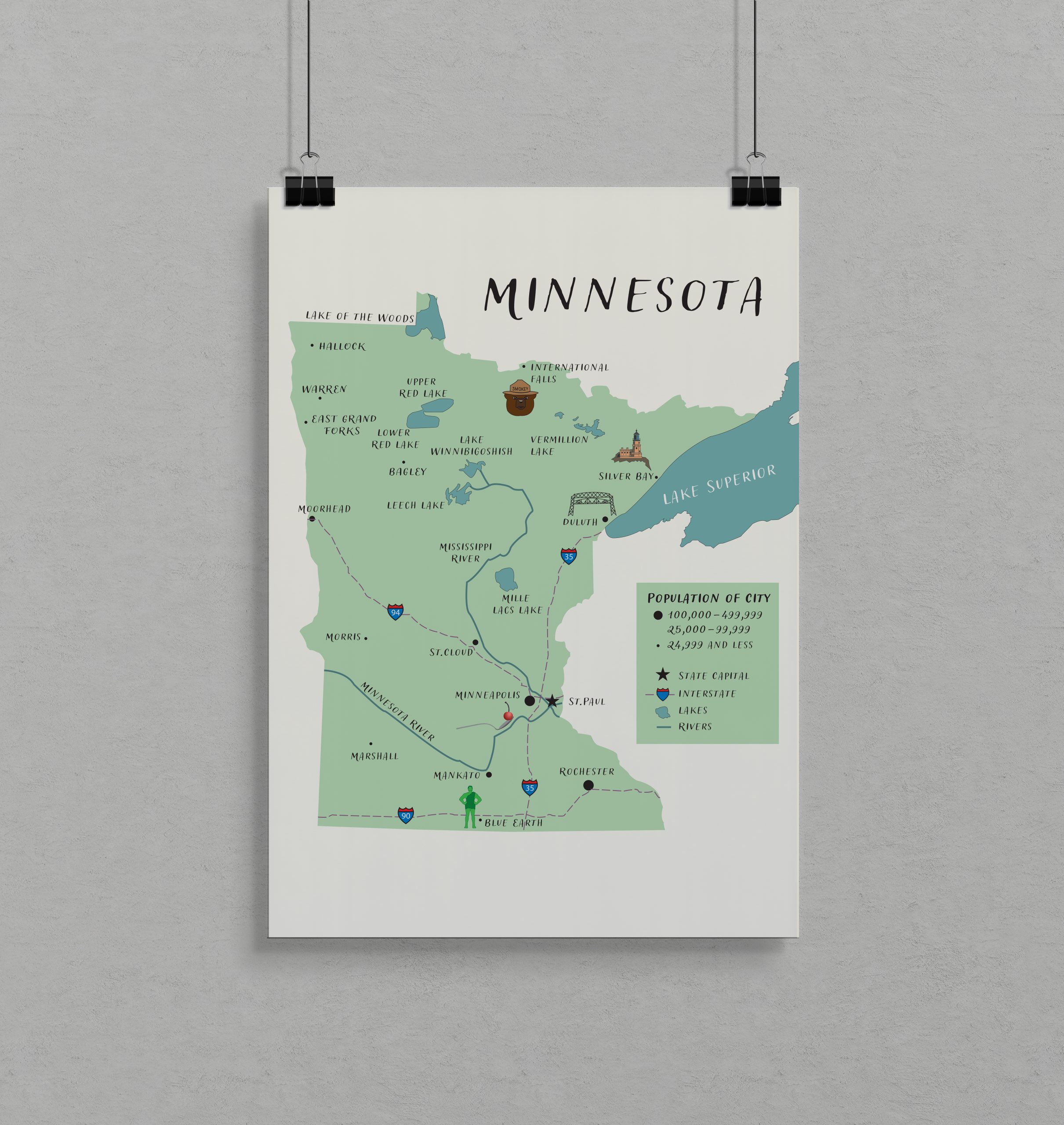
Illustrated Map
The assignment was to create an illustrated map of Minnesota. I created it in Adobe Illustrator to combine clear geographic information with a
playful, hand-drawn style. The goal was to communicate key features like cities, lakes, rivers, and interstates while adding personality through simple illustrations and icons. A key challenge was balancing readability with visual interest. I solved this by using a limited color palette, clean hierarchy, and consistent icon design, ensuring the map remained clear without feeling overly technical.

